Zoning in Los Angeles is informed by the goals and policies of the City’s General Plan. The Land Use Element of the General Plan establishes neighborhood-specific goals, and implements strategies aimed at bolstering local housing, economic growth, and job opportunities across the City.
Zoning is how cities, such as Los Angeles, translate the citywide vision and goals of the General Plan into targeted land use regulations, providing guidance on the types of projects that can be constructed and the uses that are allowed.
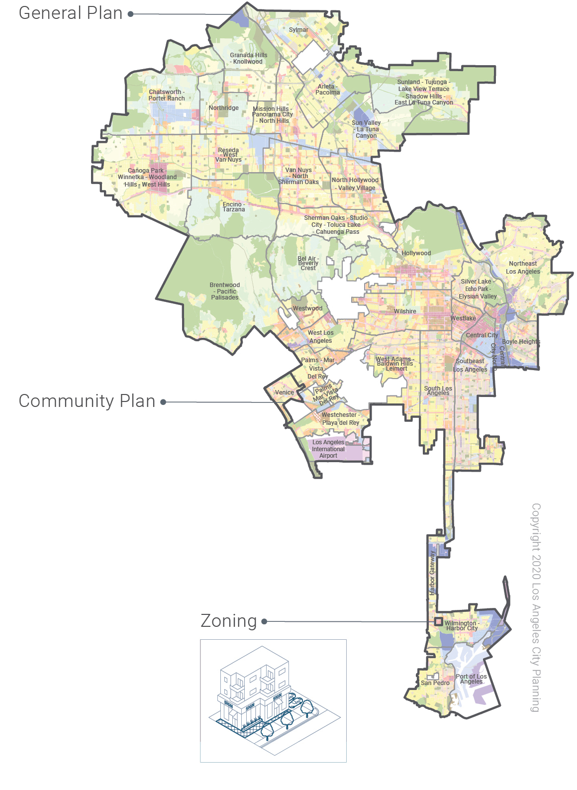
The Land Use Element in Los Angeles comprises 35 Community Plans, each of which includes a policy document and land use map. Both the policy document and land use map help inform the range of zones that are applied to individual properties.
General Plan
The General Plan establishes a set of policies and land use designations that outline how land should be used and resources allocated, and how a city should grow and evolve over time. Los Angeles's General Plan offers the vision for how the City will evolve, reflecting not only the values of its different communities but also the overarching priorities of the City.
Community Plans
Los Angeles’s 35 Community Plans compose the Land Use Element of the General Plan. While the General Plan provides the overarching vision for the City, Los Angeles’s Community Plans specify the range of zones that are allowed at a given site based on the land use designation.
Zoning
Zoning is the primary tool for implementing the policy objectives and goals of a Community Plan. Through the use of zoning, Los Angeles is able to shape development, whether by regulating the size and scale of new projects or restricting certain onsite activities based on a site's location and proximity to other uses.